Speaker Information: 4th Kenji Ishihara Colloquium Series on Earthquake Engineering
Artificial Intelligence Applications in Earthquake Engineering
Speakers and Abstracts
Karianne J. Bergen
Assistant Professor, Brown University
Explainable AI for Seismology: An interpretable convolutional neural network architecture for earthquake detection
Abstract: Geophysicists are increasingly adopting machine learning (ML) techniques to analyze seismic signals. Deep neural networks have emerged as particularly powerful tools for classifying waveforms and identifying seismic phases. These models can learn complex patterns and decision functions with high predictive accuracy. But the complexity and large number of parameters also make these “black box” models difficult to inspect or interpret. The emerging field of explainable artificial intelligence (XAI) is developing tools and techniques to enable ML solutions that can be understood by human analysts. This work presents an interpretable one-dimensional convolutional neural network (CNN) model for earthquake phase detection. In this approach, a simple CNN-based detector (Ross et al.,2018) is modified to learn representative waveforms for classification. These prototype waveforms are used directly by the model to generate the predictions and can be used to explain the model outputs. The new prediction model achieves similar prediction accuracy and has a similar architecture to the original CNN model, but with the added benefit of greater interpretability.
Bio: Dr. Karianne J. Bergen is an Assistant Professor of Data Science and Earth, Environmental and Planetary Sciences at Brown University and Assistant Professor of Computer Science. Her research interests are in scientific machine learning and trustworthy and explainable AI. Her past work has focused on machine learning and data mining techniques for pattern recognition and discovery in large, complex sensor datasets, including her dissertation research on large-scale earthquake detection in regional seismic networks. Dr. Bergen earned a Ph.D. and M.Sc. in Computational and Mathematical Engineering from Stanford University, and a B.Sc. in Applied Mathematics from Brown University. She completed her postdoctoral training at Harvard University where she was a Data Science Initiative Postdoctoral Fellow in Computer Science and Earth and Planetary Sciences. Prior to starting her graduate work, Dr. Bergen worked as a staff data scientist in the Biological and Chemical Defense Systems Group at MIT-Lincoln Laboratory.
Scott J. Brandenberg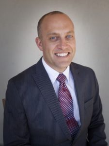
Professor, University of California, Los Angeles
Relational Databases to Facilitate Ground Motion and Liquefaction Data Science
Abstract: Preparing, validating, and storing large datasets is often the most complicated aspect of any data science project. This presentation will focus on relational databases that have been assembled to store earthquake ground motion data in California and liquefaction case history data from around the world. The organizational structure of the databases will be briefly discussed, followed by a focus on graphical user interfaces, application programming interfaces, and queryable copies of the database in DesignSafe that allow users to interact with the data. A machine learning algorithm developed to automatically identify soil layers from cone penetration test data will be presented as an example application of relational databases in data science.
Bio: Scott J. Brandenberg is a Professor in the Civil and Environmental Engineering Department at the University of California, Los Angeles. His research expertise lies primarily in geotechnical earthquake engineering, with focus on soil-structure interaction, multi-hazard reliability of levee systems, the response of deep foundations to liquefaction-induced lateral spreading, seismic earth pressures acting on earth retention systems, and cyberinfrastructure projects, including development of community databases for liquefaction assessment. He has authored over 100 technical papers, and received the 2022 Thomas A. Middlebrooks Award, 2015 Walter L. Huber Award, 2013 Shamsher Prakash Research Award, and 2010 Arthur Casagrande Professional Development Award. He earned his PhD and MS in 2005 and 2002, respectively, from the University of California, Davis, and his BS in 2000 from Cal Poly, San Luis Obispo. He served as the Associate Dean for Diversity and Inclusion in the UCLA Samueli School of Engineering from 2017 through 2020.
Youssef Hashash
Professor, University of Illinois at Urbana-Champaign
Deep Learning-Based Site Amplification Models for Central and Eastern North America
with Okan Ilhan
Abstract: This presentation will describe development of deep learning/Artificial neural network (ANN)-based response spectrum (RS) and Fourier amplitude spectrum (FAS) site amplification models for Central and Eastern North America (CENA) using a large-scale simulation database. The amplification database used in model development was produced through large-scale one-dimensional site response analyses for a total of over 3 million analyses. The linear, nonlinear, and total RS and FAS models adopt identical inputs with the corresponding conventional function and produce significantly reduced bias relative to their conventional counter parts. The analogous ANN structure can model all kinds of simulated amplification data (e.g. linear or nonlinear) and is capable of utilizing any site or motion-dependent inputs thought to affect amplification behavior including VS30 and site natural period (Tnat), thus alleviating the need for pre-defined model functional forms for different types of simulation dataset. The deep learning models more accurately represent site-specific amplification compared to conventional relationships.
Bio: Professor Youssef Hashash holds a B.S. (1987), an M.S. (1988) and a Ph.D. (1992) in civil engineering from the Massachusetts Institute of Technology. He began his career with the PB/MK TEAM in Dallas on the Superconducting Super Collider Project. In 1994 he joined Parsons Brinckerhoff in San Francisco and worked on a number of underground construction projects in the U.S. and Canada including the Boston Central Artery/Tunnel project.
Professor Hashash joined the faculty of the Department of Civil and Environmental Engineering at the University of Illinois at Urbana-Champaign in 1998. He teaches courses in Geotechnical Engineering, Numerical Modeling in Geomechanics, Geotechnical Earthquake Engineering, Tunneling in Soil and Rock, and Excavation and Support Systems. His research focus includes deep excavations and tunneling in urban areas, earthquake engineering, continuum and discrete element modeling and soil-structure interaction as well as resiliency and sustainability of the built infrastructure. He also works on geotechnical engineering applications of deep learning, artificial intelligence, visualization, augmented reality, imaging and drone technologies. He has published numerous journal articles and is co-inventor on four patents. His research group developed the software program DEEPSOIL that is used worldwide for evaluation of soil response to earthquake shaking.
Professor Hashash is a Fellow of the American Society of Civil Engineers (ASCE), a past president of the Geo-institute of ASCE and has received a number of teaching, university and professional awards including the Presidential Early Career Award for Scientists and Engineers and the ASCE 2014 Peck medal. He was elected to the National Academy of Engineering in 2022.
Qingkai Kong
Research Scientist, Lawrence Livermore National Laboratory
Crowdsourcing Earthquake Information Enabled by AI
Abstract: In this talk, our efforts in the area of crowdsourcing earthquake information will be presented. The first part of the talk will be MyShake, a smartphone seismic network to collect earthquake motions and issue earthquake early warning from daily smartphones. A series of machine learning algorithms are utilized to solve some of the challenging problems from distinguish human activities to estimating the earthquake parameters. Second part of the talk will discuss how we built an automated pipeline relying on a transfer learning-based model to extract the damaged buildings images after earthquakes from social media platforms such as Twitter in near real-time. Moreover, with the data science tools available these days, useful public response information from Twitter and Reddit can also be extracted to enhance our post-earthquake information collection.
Bio: Qingkai Kong is currently a research scientist at Lawrence Livermore National Laboratory, where his research is mainly focused on how to combine machine learning with prior physics information in various seismological problems. Before he joined the lab, he was an Assistant Researcher at Berkeley Seismology Lab working between Earth Science and Data Science, where he built the MyShake smartphone seismic network. He also worked as a visiting researcher in the visiting faculty program at Google, Mountain View, to help build the Android Earthquake Alerting System.
Krishna Kumar
Assistant Professor, University of Texas at Austin
Can we trust AI models in Earthquake Engineering?
Abstract: Machine Learning is a ‘black box’ technique – a large number of parameters and complexity of learned representations can prevent researchers from describing what information is relevant to a model’s prediction. This talk will open the black box to explain the logic and reasoning behind ML predictions in earthquake engineering applications. Explainable models include post-hoc techniques, glass-box models, and deriving physics laws from observations. Post-hoc techniques such as LIME and SHAP values assign importance metrics to different parameters in the dataset, thus explaining what features led to the classification or regression. We will present a random forest algorithm developed for classifying liquefiable sites based on CPT data and topological features from the NZ liquefaction database. Although the random forest model has a very high predictive ability of 85%, we reveal that the model learned incorrect physics using explanations (X-AI). We will also explore other post-hoc techniques such as GRADCAM to identify regions of interest in performing a full-waveform inversion. We develop exploratory techniques using Total Variation to look into the black box neural networks. Although post hoc explanations offer some degree of interpretability, merely investigating the cases where the model works may not reveal serious gotchas. Unlike explainable models, Glass box models provide a fully interoperable approach to ML, where one can explicitly see how the model works and follow every step along the way from input to the final output. We create Physics-Informed explainable trees (PiX-trees) for liquefaction classification by developing individual and correlated relationships between factors affecting liquefaction and potential failure. The ultimate goal of explainability is to derive new unknown knowledge or physics laws. We will explore techniques such as knowledge distillation to derive fully explainable models that offer insight into physics. Finally, we will derive known and unknown physics laws that describe the runout dynamics of an earthquake-induced landslide using graph networks.
Bio: Krishna Kumar is an Assistant Professor in Civil, Architecture, and Environmental Engineering at the University of Texas at Austin. Krishna completed his Ph.D. from the University of Cambridge in 2015 on multi-scale multiphase modeling of granular flows and was supervised by Professor Kenichi Soga. Krishna’s research interest spans high-performance computing, numerical modeling, and explainable AI of natural hazards. He has developed massively parallel micro-/macro-scale numerical methods: Graph Network Simulator, Material Point Method, Lattice Boltzmann – Discrete Element coupling, and Lattice Element method. Krishna was awarded C. S. Desai Award for the best paper on constitutive modeling of geologic materials by the Indian Geotechnical Society.
Youzuo Lin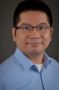
Staff Scientist, Los Alamos National Laboratory
Spatio-Temporal Graph Convolutional Networks for Earthquake Source Characterization
Abstract: Accurate earthquake location and magnitude estimation play critical roles in seismology. Recent deep learning frameworks have produced encouraging results on various seismological tasks (e.g., earthquake detection, phase picking, seismic classification, and earthquake early warning). Most existing machine learning earthquake location methods utilize waveform information from a single station. However, multiple stations contain more complete information for earthquake source characterization. Inspired by recent successes in applying graph neural networks in graph-structured data, we develop a Spatio-Temporal Graph Convolutional Neural Network (STGCN) for estimating earthquake locations and magnitudes. Our graph neural network leverages geographical and waveform information from multiple stations to construct graphs automatically and dynamically by an adaptive feature integration process. Given input waveforms collected from multiple stations, the neural network constructs different graphs and fuses spatial-temporal consistency effectively from various stations based on graphs’ edges. Using a recent graph neural network and a fully convolutional neural network as baselines, we apply STGCN to earthquakes cataloged by Southern California Seismic Network from 2000 to 2019 and induced earthquakes collected in Oklahoma from 2014 to 2015. STGCN yields more accurate earthquake locations than those obtained by the baseline models and performs comparably in terms of depth and magnitude prediction, though the ability to predict depth and magnitude remains weak for all tested models. Our work demonstrates the potential of using graph neural networks and multiple stations for better automatic estimation of earthquake epicenters.
Bio: Youzuo Lin is a staff scientist and the Team Leader for the Sensor and Signatures Team at Los Alamos National Laboratory (LANL). His research interests include physics-informed machine learning, time series analysis, seismic inversion, and computational methods for solving ill-posed inverse problems. Particularly, he has worked on a wide spectrum of applications including Earthquake detection and monitoring, CO2 storage, hydrology inverse modeling, and ultrasound tomography for breast cancer detection. He has been a co-inventor on a couple of U.S. patents about ultrasound imaging techniques. He has published more than 70+ articles in top journals and conferences. Dr. Lin is an Associate Editor of Machine Learning: Science and Technology and co-edited the 2021 Special Issue in IEEE Transactions on Neural Networks and Learning Systems and the 2019 Special Issue in Journal of Interpretation: Machine Learning in Seismic Data Analysis. Dr. Lin holds a Ph.D. degree in Applied and Computational Mathematics from Arizona State University.
Jorge Macedo
Assistant Professor, Georgia Institute of Technology
Machine learning-based procedures for estimating seismically-induced slope displacements
Abstract: The assessment of the seismic performance of slope systems often relies on estimating the amount of seismically-induced slope displacements (D) using semiempirical models. These models take as inputs the slope properties and ground motion intensity measures (IMs) to provide D estimates that are used in engineering design. However, most of the available models have been developed for regions affected by shallow crustal seismicity. Comparatively, the available models for subduction tectonic settings are scarce. Moreover, most existing models have been developed using traditional statistical methods that do not take full advantage of modern data-driven approaches. This presentation will discuss the development of new machine learning (ML) based D models applicable to shallow crustal and subduction earthquake zones (considering both interface and intraslab mechanisms). The performance of the developed ML-based models is compared in terms of predictive performance, model trends, and computational cost for training. Lastly, the use of the developed models in performance-based earthquake engineering will also be briefly discussed.
Bio: Dr. Jorge Macedo, Ph.D., P.E., is an Assistant Professor in the School of Civil and Environmental Engineering at the Georgia Institute of Technology, where he joined the faculty in 2018. Dr. Macedo practiced as a geotechnical tailings engineer for six years (2008-2013), working on major mining and earthquake engineering projects in Peru, Argentina, Chile, and Brazil from conception to detailed engineering design, and he holds P.E licenses in California and Peru. Dr. Macedo’s main research areas are geotechnical earthquake engineering, mining geotechnics, and data-driven risk engineering applied to multi-hazards. He received the prestigious 2022 United States National Science Foundation CAREER award for his work at the convergence of performance-based engineering, tailings geotechnics, and data science. Dr. Macedo is also the founder and chair of the TAILENG (TAilings and IndustriaL waste ENGineering) center, which works on improving the resilience of infrastructure in the mining and power industries.
Hiroyuki Miura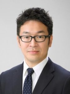
Associate Professor, Hiroshima University
Application of AI Technology for Estimating Site Amplification Factor from Microtremor H/V Spectral Ratio
coauthored with Da Pan
Abstract: Recent Artificial Intelligence (AI) technologies including deep neural network-based learning have been expanded to various fields not only for image and sound recognitions but also for earthquake and structural engineering issues. This study introduces an application of deep neural network for automatically estimating site amplification factor of seismic wave (S-wave) in frequency domain from microtremor data. The proposed model was developed from observed earthquake and microtremor data at the seismic stations in Chugoku district, western Japan. The model can automatically produce the site amplification factor from microtremor horizontal-to-vertical (H/V) spectral ratio without external investigation such as geophysical exploration and long-term seismic observation. The accuracies and applicability of the method are also discussed in the presentation.
Bio:
Education:
Doctor of Engineering, Department of Built Environment, Tokyo Institute of Technology, Japan (2004)
Master of Engineering, Department of Built Environment, Tokyo Institute of Technology, Japan (2001)
Bachelor of Engineering, Faculty of Engineering, Tokyo Institute of Technology, Japan (1999)
Experience:
2004.4-2007.9, Postdoctoral Research Fellow, Tokyo Institute of Technology
2007.10-2012.10, Assistant Professor, Tokyo Institute of Technology
2012.10-Present, Associate Professor, Hiroshima University
Research Interests:
Evaluation of ground motion characteristics based on strong motion and mictotremor data
Earthquake damage assessment of buildings
Spatial data analysis for urban disaster mitigation planning
Awards:
Young Researcher Award by Japan Association for Earthquake Engineering (JAEE), 2008
Excellent Presentation Award in JAEE Annual Meeting, 2009
Excellent Presentation Award in JAEE Annual Meeting, 2011
Outstanding Paper Award by Institute of Social Safety Science (ISSS), 2016.
Outstanding Paper Award by Institute of Social Safety Science (ISSS), 2018.
Professional Affiliations:
Architectural Institute of Japan (AIJ), Japan Association for Earthquake Engineering (JAEE), The Seismological Society of Japan (SSJ), Institute of Social Safety Science (ISSS), Earthquake Engineering Research Institute (EERI), Seismological Society of America (SSA)
Principle Publications selected
Peer-reviewed articles (Related to Artificial Intelligence and Earthquake Engineering):
- Pan, D., Miura, H., Kanno, T., Shigefuji, Abiru, T.: Deep Neural Network-based Estimation of Site Amplification Factor from Microtremor H/V Spectral Ratio, Bulletin of the Seismological Society of America, 2022, https://doi.org/10.1785/0120210300 .
- Tumurbaatar, Z., Miura, H., Tsamba, T.: Development of Building Inventory Data in Ulaanbaatar, Mongolia for Seismic Loss Estimation, ISPRS International Journal of Geo-Information, 11(1), 26, 2021, https://doi.org/10.3390/ijgi11010026 .
- Adriano, B., Yokoya, N., Xia, J., Miura, H., Liu, W., Matsuoka, M. and Koshimura, S.: Learning from Multimodal and Multitemporal Earth Observation Data for Building Damage Mapping, ISPRS Journal of Photogrammetry and Remote Sensing, Vol.175, pp.132-143, 2021, https://doi.org/10.1016/j.isprsjprs.2021.02.016 .
- Miura, H., Aridome, T. and Matsuoka, M.: Deep Learning-based Identification of Collapsed, Non-collapsed and Blue Tarp-Covered Buildings from Post-disaster Aerial Images, Remote Sensing, Vol.20, No. 12, 1924, 2020, https://doi.org/10.3390/rs12121924 .
- Miura, H., Okamura, T., Matsuoka, M., Leal, M., Garcia, H. and Pulido, N.: Empirical Models for Surface and Body Wave Amplifications of Response Spectra in the Bogotá Basin, Colombia, Bulletin of the Seismological Society of America, Vol.109, No.3, pp.987-1004, 2019, https://doi.org/10.1785/0120180154 .
- Miura, H., Fujita, H., Than, K. S. S. and Hibino, Y.: Estimation of Site Response during the 2016 Chauk, Myanmar Earthquake Based on Microtremor-derived S-wave Velocity Structures, Soil Dynamics and Earthquake Engineering, Vol.126, 105781, 2019, https://doi.org/10.1016/j.soildyn.2019.105781 .
- Miura, H., Midorikawa, S. and Matsuoka, M.: Building Damage Assessment Using High-Resolution Satellite SAR Images of the 2010 Haiti Earthquake, Earthquake Spectra, Vol.32, No.1, pp.591-610, 2016.
- Midorikawa, S., Yamanaka, H., Chimoto, K., Riddell, R., Miura, H. and Saguchi, K.: Evaluation of Site Effects on Strong Ground Motion Records in Concepcion during the 2010 Maule, Chile Earthquake, Bulletin of the Seismological Society of America, Vol.104, No.5, pp.2503-2511, 2014.
- Miura, H., Midorikawa, S. and Kerle, N.: Detection of Building Damage Areas of the 2006 Central Java, Indonesia Earthquake through Digital Analysis of Optical Satellite Images, Earthquake Spectra, Vol.29, No.2, pp.453-473, 2013.
- Stewart, J. P., Midorikawa, S., Graves, R. W., Khodaverdi, K., Kishida, T., Miura, H., Bozorgnia, Y. and Campbell, K. W.: Implication of Mw 9.0 Tohoku-oki Japan Earthquake for Ground Motion Scaling with Source, Path, and Site Parameters, Earthquake Spectra, Vol.29, No.S1, pp.S1-S21, 2013.
- Midorikawa, S., Miura, H. and Atsumi, T.: Strong Motion Records of the 2011 Tohoku Earthquake and Its Attenuation Characteristics, Journal of Disaster Research, Vol.7, No.6, pp.695-700, 2012.
- Miura, H., Midorikawa, S., Fujimoto, K., Pacheco, B. M., and Yamanaka, H.: Earthquake Damage Estimation in Metro Manila, Philippines Based on Seismic Performance of Buildings Evaluated by Local Experts’ Judgments, Soil Dynamics and Earthquake Engineering, Vo.28, No.10-11, pp.764-777, 2008.
- Miura, H. and Midorikawa, S.: Updating GIS Building Inventory Data Using High-Resolution Satellite Images for Earthquake Damage Assessment: Application to Metro Manila, Philippines, Earthquake Spectra, Vol.22, No.1, pp.151-168, 2006.
Jamie E. Padgett
Stanley C. Moore Endowed Professor and Department Chair, Rice University
Facilitating seismic risk and resilience analysis in heterogenous and multi-scale systems
coauthored with Raul Rincon
Abstract: The exposure of the built environment to aging, deterioration effects and shifts in demands combined with the occurrence of extreme events, such as earthquakes, poses unique challenges to modelers, designers, and managers of structures and infrastructure systems, and the communities that depend upon their effective functioning. The fields of earthquake risk and resilience engineering aim to support such endeavors and necessarily benefit from the integration different methods and perspectives. Artificial intelligence (AI) has been one of the cross-disciplinary fields that has permeated the earthquake engineering (EE) community in the most recent decade. Specific to AI, the machine learning (ML) field introduces capabilities for modeling, analyzing, visualizing and discovering different aspects of the built environment and its performance when subjected to natural hazards that otherwise would be challenging to achieve. In this talk we discuss how evolving developments in ML have transformed the EE community, and offer illustrative examples of research performed, and currently ongoing, in our research lab. As an example, we present the use of supervised ML for uncertainty propagation and fragility estimation in settings where the number and variety of parameters, the randomness in these parameters, and the consideration of time-varying characteristics would lead to infeasible (or very expensive) schemes if using traditional approaches. Beyond efficiency, supervised and unsupervised methods (and combinations of them) are presented herein as mechanisms for discovering the structure and seismic demand parameters that most contribute to the seismic performance and post-event functionality of structural components, structural systems, and larger infrastructure systems. Hence, we demonstrate how advances in ML and its application facilitate not only transformative research but also pave a path to support practical design, management and community resilience planning.
Bio: Jamie E. Padgett is the Stanley C. Moore Endowed Professor and Department Chair of Civil and Environmental Engineering at Rice University in Houston, TX. Padgett is a structural engineer with a passion for engineering for social good. Her research is focused on multi-hazard risk and resilience modeling of structures and infrastructure systems, and understanding their impacts on communities. Her work develops new methods to quantify and improve the performance of infrastructure exposed to natural hazards such as earthquakes, hurricanes and flooding. Padgett’s research has applications to a range of systems, including bridges, tank farms, energy and industrial facilities, and intermodal transportation systems. She has published over 250 articles in journals or archived conference proceedings in the general area of structural fragility, life-cycle assessment, and infrastructure resilience. Dr. Padgett has received several prestigious awards and recognitions including the Executive Leadership in Academic Technology, Engineering and Science (ELATES) Fellowship (2021-2022); Engineering Mechanics Institute (EMI) Objective Resilience Distinguished Lecturer (2019); the American Society of Civil Engineering (ASCE) Walter L. Huber Civil Engineering Research Prize (2017); and the National Science Foundation (NSF) Faculty Early Career Development (CAREER) Award (2011). She is a Fellow of ASCE’s Structural Engineering Institute (SEI) and the founding Chair of its technical committee on Multiple Hazard Mitigation. Among other advisory and professional service roles, Padgett serves on Editorial Boards for such journals as the ASCE Journal of Structural Engineering, Natural Hazards Review, and Earthquake Engineering and Structural Dynamics. Padgett serves in leadership roles within several large national research efforts including the NIST Center of Excellence for Risk-based Resilience Planning, the NSF Natural Hazards Engineering Research Infrastructure (NHERI) Cyberinfrastructure “DesignSafe-CI”, and the Severe Storm Prediction Education and Evacuation from Disasters (SSPEED) Center. She is the Faculty Director of the inaugural Gulf Scholars Program at Rice University funded by NASEM’s Gulf Research Program, and a Fellow of Rice’s Kinder Institute for Urban Research.
Adrian Rodriguez-Marek
Professor, Virginia Tech
Use of Machine Learning Tools to Evaluate Site Terms in Ground Motion Models
coauthored with Mohsen Zaker Esteghamati, Balakumar Anbazhagan, and Albert R. Kottke
Abstract: This study develops a data-driven framework to improve the prediction of site amplification in ground motion models using horizontal-to-vertical spectral ratios (HVSR) proxies. Three machine learning algorithms (multiple regression, random forest, and support vector machine) were implemented in an automated data-driven workflow that included feature selection (filter-based, wrapper-based, and embedded methods), hyperparameter tuning, and cross-validation modules. The site-to-site variability of resultant data-driven models was then compared to a Fourier Amplitude Spectrum baseline ground motion model. In addition, sensitivity analysis on framework choices was carried out. The results show that data-driven models with HVSR proxies derived from strong motion data provide lower site-to-site variability than conventional GMM. The best performing data-driven model (i.e., support vector machines) showed an average of 24.1% (and up to 50.8 %) lower site-to-site variability than the baseline ground motion model, where the difference was more significant at lower frequencies. The use of noise-based HVSR measures also showed promise, but the improvements over traditional proxy-based approaches were not as marked.
Bio: Click here to learn about Dr. Rodriguez-Marek.
Rodrigo Silva-Lopez and Jack Baker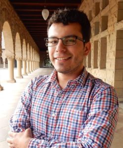
Ph.D. Candidate, Stanford University
Professor, Stanford University
Deep learning-based retrofitting and seismic risk assessment of road networks
Abstract: Seismic risk assessment of road systems involves computationally expensive traffic simulations to evaluate the system’s performance. To accelerate this process, we developed a neural network surrogate model that allows rapid and accurate estimation of changes in traffic performance metrics due to bridge damage. In addition to the neural network, a modified version of the Local Interpretable Model-Agnostic Explanation (LIME) is proposed as a retrofitting strategy that minimizes earthquakes’ impact on the system. The modified version (LIME-TI) uses Traffic Impacts and rates of occurrence to aggregate the importance of individual damage realizations during the computation of variable importance. Using the San Francisco Bay Area Road network as a testbed, we verified that the neural network accurately predicts the system’s performance while taking five orders of magnitude less time to compute traffic metrics. Moreover, the proposed LIME-TI retrofitting strategy is superior to others (such as traffic volume or vulnerability) in identifying bridges whose retrofit effectively improves network performance.
Bio: Rodrigo Silva-Lopez is a Ph.D. Candidate at Stanford University. His research focuses on improving the seismic resilience of road networks by developing and implementing machine learning and optimization techniques. In addition, his work has aimed at exploring the community impacts of road network disruption to inform decision-makers about broader implications of potential mitigation actions.
Click here to learn about Dr. Jack Baker.
Aidin Tamhidi and Yousef Bozorgnia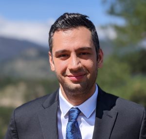
Ph.D. Candidate, University of California, Los Angeles
Professor, University of California, Los Angeles
Artificial Intelligence and Earthquake Engineering; Application for Seismic Performance of Soft-Story Buildings
Abstract: This study outlines a methodology for seismic performance quantification and rapid generation of structural computer models for an inventory of soft, weak, and open-front (SWOF) story buildings using Artificial Intelligence (AI) Neural Networks. Los Angeles city serves as a testing ground for our framework, as it contains around 13,500 SWOF structures. After a significant earthquake, the conventional damage assessment of such buildings is undertaken visually, which might take months. Consequently, the capacity to conduct quick post-earthquake structural health assessments is an essential skill. To achieve this, it is necessary to characterize computer structural model for target buildings using inventories of archetype models established based on structural properties. We offer a trained Convolutional Neural Network (CNN) model capable of classifying the first-story wall layout and number of stories for the target buildings. The building identification evaluation of the proposed CNN model shows acceptable accuracies in comparison with the human detection error. Furthermore, the CNN’s gradient-weighted class activation maps indicate the capacity to recognize wall opening patterns corresponding to the first-story wall layouts. The resultant estimates of the proposed CNN model can be combined with additional data from other sources, such as satellite photos or OpenStreet map’s input data, to determine the closest archetypal structural model, enabling quick assessment of post-earthquake structural damage. Pre-event developed computer models of the identified buildings are assigned to each building and excited by generated site-specific time histories to evaluate seismic performance of a large class of buildings in a real-time manner after an earthquake.
Bio: Aidin Tamhidi is a Ph.D. candidate in Structural and Earthquake Engineering at University of California, Los Angeles. He received his B.Sc. in Civil and Environmental Engineering and M.Sc. in Structural Engineering both from Sharif University of Technology (Iran). His research is about Next-Generation Earthquake Field Data Measurements and their Use to Assess Earthquake Performance of Soft-Story Buildings. He is conducting his research under the supervision of Professor Yousef Bozorgnia.

